|
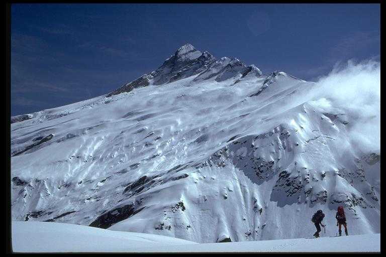
Mt Hooker from the Solution range. The Solution range separates the Clarke river from the Landsborough. Mark's Flat lies below. A large flat expanse of tussock, it proved to be a half-frozen bog which made crossing difficult - I had managed to keep the inners of my plastics relatively dry in preparation for the climb the next day, but it was all in vain. Mark's Flat is home to several paradise ducks and a couple of famous rock bivies - a must destination for any serious tramper. In the 1970s a couple of dodgy airstrips (now vanished) allowed hunters to cull local deer populations... consequently the bush is considerably more difficult to travel through - particularly in the upper Otoko. However, this is a small price to pay compared with the devastation caused by deer. The Kea Bluffs are off to the left in this view, out of camera. West Coast clag is threatening to move in on the right.
|