


| | | | | New Zealand/Aotearoa - An interactive map |
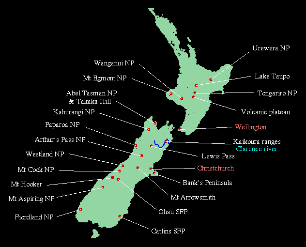
Click on the place names!- Most have links, some don't. Soon you will be able to click on the map itself to visit more places!New Zealand is long and thin and consists of three main islands, imaginatively named the North Island, the South Island and Stewart Island. There are islands to the South: the Auckland Islands, Campbell, Bounty, Antipodes etc and then there is the Ross Dependency in Antarctica. In the North there are the Kermedec Islands, Three Kings Islands and the Cook Islands are a protectorate of NZ. In the East there are the Chatham Islands. Of course in the West there is the West Island (also known as Australia). The main part of NZ spans a latitude of 34-47 degrees. Wellington, at the bottom of the North Island is the Southern-most capital city in the world but has a latitude equivalent to Rome. |
|
Back to Jonathan's gallery Copyright (c) 1996 Jonathan Carr |