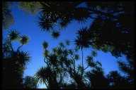
| Christchurch's greatest asset is Bank's Peninsula of which the Port Hills border the city itself. 8-5 million years ago Banks Peninsula was active with two centres, Lyttleton and Akaroa. The last centre of activity was Mt Bradley and Mt Herbert (920m) which form the southern rim of the Lyttleton crater. Small sea/lava caves can be found at many points along the coastline including Okain's Bay. Sea kayaking would be a great way to explore the otherwise inaccessible parts of the coastline.
Bank's Peninsula exhibits many varied micro climates and influences Christchurch's weather. It's great for day walks, mountain biking, rock climbing, orienteering and getting fit! ...or, best of all, just escaping the city for a night or a weekend. Unfortunately, the great forests and the accompanying bird life are now greatly depleted, but there are some small pockets of bush to be sought out. There are dolphins (the rare Hector's dolphin - world's smallest I think), occasionally penguins and many sea birds to be seen. |


