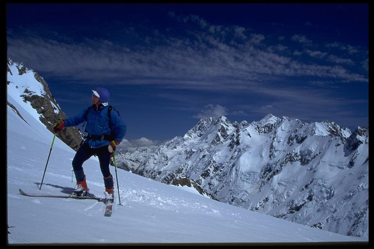


 |  |  | Mt De La Beche, Mt Cook National Park |
 |
|
Beneath Mt De La Beche at the top of the Rudolph Glacier, looking South towards Mt Cook. The distinctive "flat" summit ridge (NZ's highest mile) and the East face of Mt Cook appear in the centre of the picture. The rounded ice summit of Mt Tasman (to the right) appears to be almost as high as Cook.
The Main Divide forms a ridge of 3000m peaks extending northeast from Mt Dampier (just below the high peak of Mt Cook). It includes Mt Tasman and the Minarets right up to Elie de Beaumont. The Tasman glacier fills the valley on the Eastern side while the 2000m ice and rock wall of the Divide hides the neves of the Fox and Franz Joseph Glaciers in the West. These can be accessed via Graham's saddle which is just out of the picture, to the right and below us. The Tasman Sea is only a few km away.
The skiis look good, but they had to be carried 20kms up the Tasman moraine. We set off from De La Beche corner - having to descend 200m down the moraine wall on to the Tasman Glacier before joining the Rudolph glacier was a bit annoying. Despite what the guide book says, I think De La Beche ridge might be the better way to go. We also discovered why it pays to avoid the ice fall midway up the Rudolph. The greatest problem on this trip was the extreme heat and UV.
|
|
Mt Cook overview | Back to Jonathan's gallery Copyright (c) 1996 Jonathan Carr |