


| | | The Waimakariri river, Arthur's Pass |
 |
|
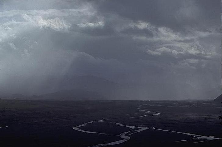
Looking up the Waimakariri towards Klondyke Corner. This is a typical East Coast braided river. Long trudges up river beds like this is very much a part of NZ climbing. The highest Peaks in Arthur's Pass lie on the Shaler Range and involve a 10-15km boulder-bash up the Waimak. Its not too bad (the Rangitata and Rakaia are far longer) - fast people get to Carrington Hut, on the way to Mt Murchison (2400m) in 2hrs, most trampers take 3-4 hours. But it can seem longer! Still it has to be done... and often on a Friday night or early Saturday morning before the sun is up. Although the river bed is up to 2km wide, the channels are usually not very wide and only knee deep. However, after as little as 12 hours of Norwest rain, the river can rise rapidly and it can even get bank to bank across the valley - an impressive sight. East Coast river flow rates can vary between 40 and 4000 cumecs! (The jet boat was invented in NZ to allow farmers to get up the braided sections of East Coast rivers where the channels might only be a few inches deep).
|
|
Arthur's Pass overview | General tramping overview | Back to Jonathan's gallery Copyright (c) 1994 Jonathan Carr |